Water mills and old ports in the Granary of Lancashire


Skippool water mill was one of three on the Fylde, the others being situated at Larbreck, near Great Eccleston, and Freckleton, on the Dow.
The water mill was accompanied in its operation and site, by an adjacent windmill – the windmill likely to have been of the smaller wooden peg operation, like Hambleton and Warton Mills.
Advertisement
Hide AdAdvertisement
Hide AdThe water mill operated by holding water back, from both the tidal flow from the Wyre, and fresh water coming down Skipton Brook (Main Dyke), a tributary of the Wyre.
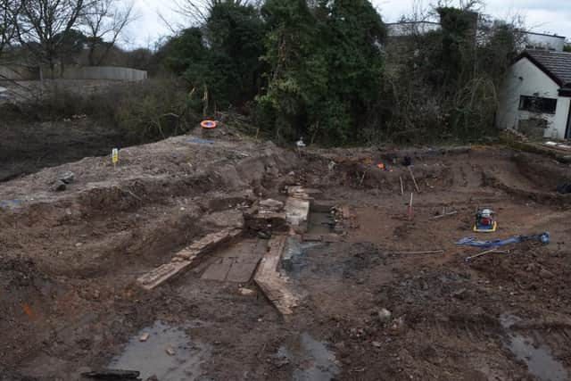
The mill is clearly marked on early maps, including Morden’s map of Lancashire 1595. The mills and surrounding land were part of Sir Thomas Brockholes’ estate-the millers being tenants.
The mill was situated at the bend of what is now Old Mains Lane, where the old Skippool bridge forked right to go to Kirkham (this was the main road in and out of Poulton) and left to go down to the Wyre banks where ships were unloaded.
This gravel track was known as Lancaster Road and continued along the bank to the Shard Ferry and ford. In the 1700s and 1800s, the Fylde was known as the Granary of Lancashire, and produced much surplus cereals for export to other English ports from the Port of Poulton, via the Coasting Trade.
Advertisement
Hide AdAdvertisement
Hide AdPrior to the development of Blackpool as a resort in the late 1700s and the new Port of Fleetwood 1n 1839, Poulton with its associated Port on the Wyre, was known as the Metropolis of the Fylde.
More historical information about the area can be found in Graham’s book - Poulton: Life Trade and Shipping in a small Lancashire Port, published by Carnegie.